Blog

Way back when before the Saylorville Dam – #Throwback Thursday

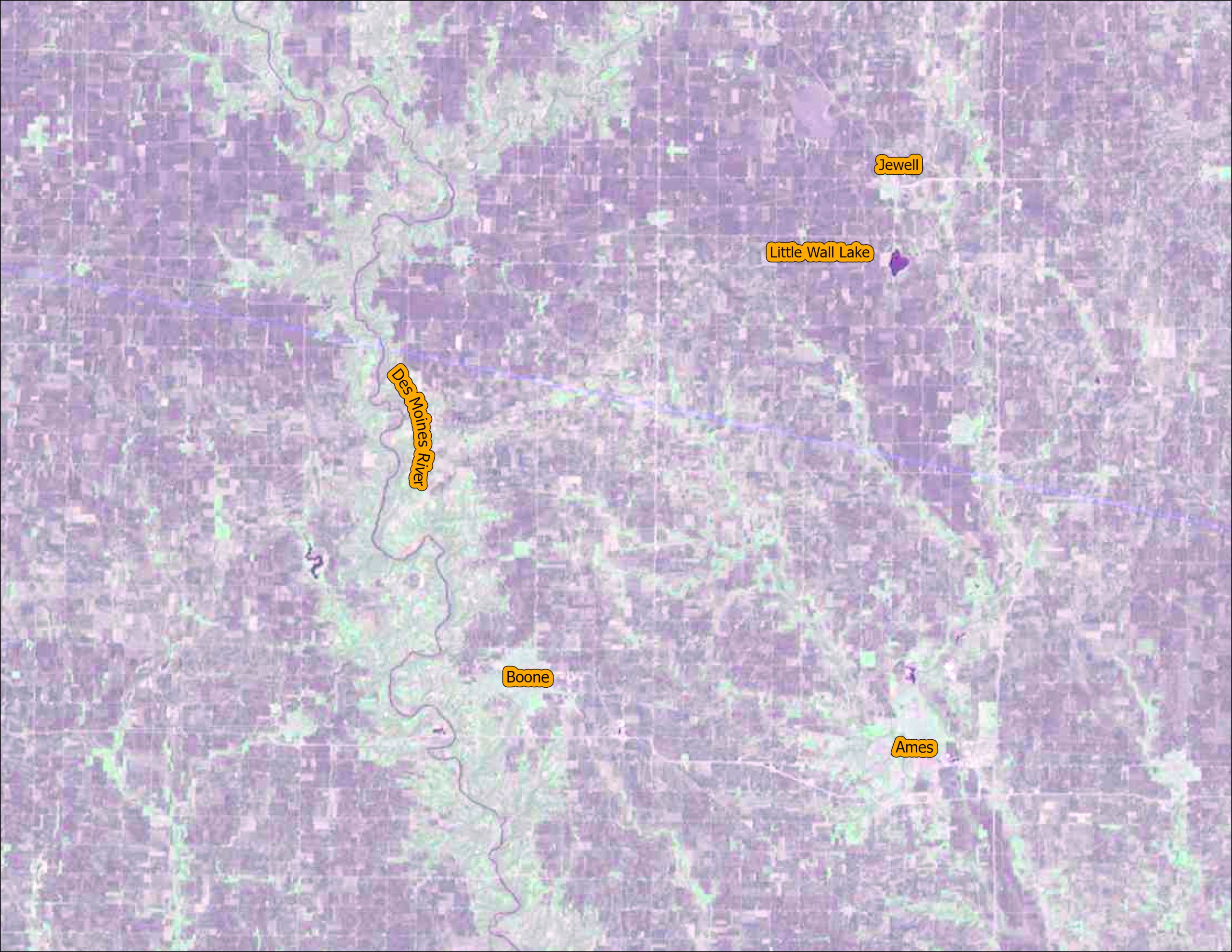
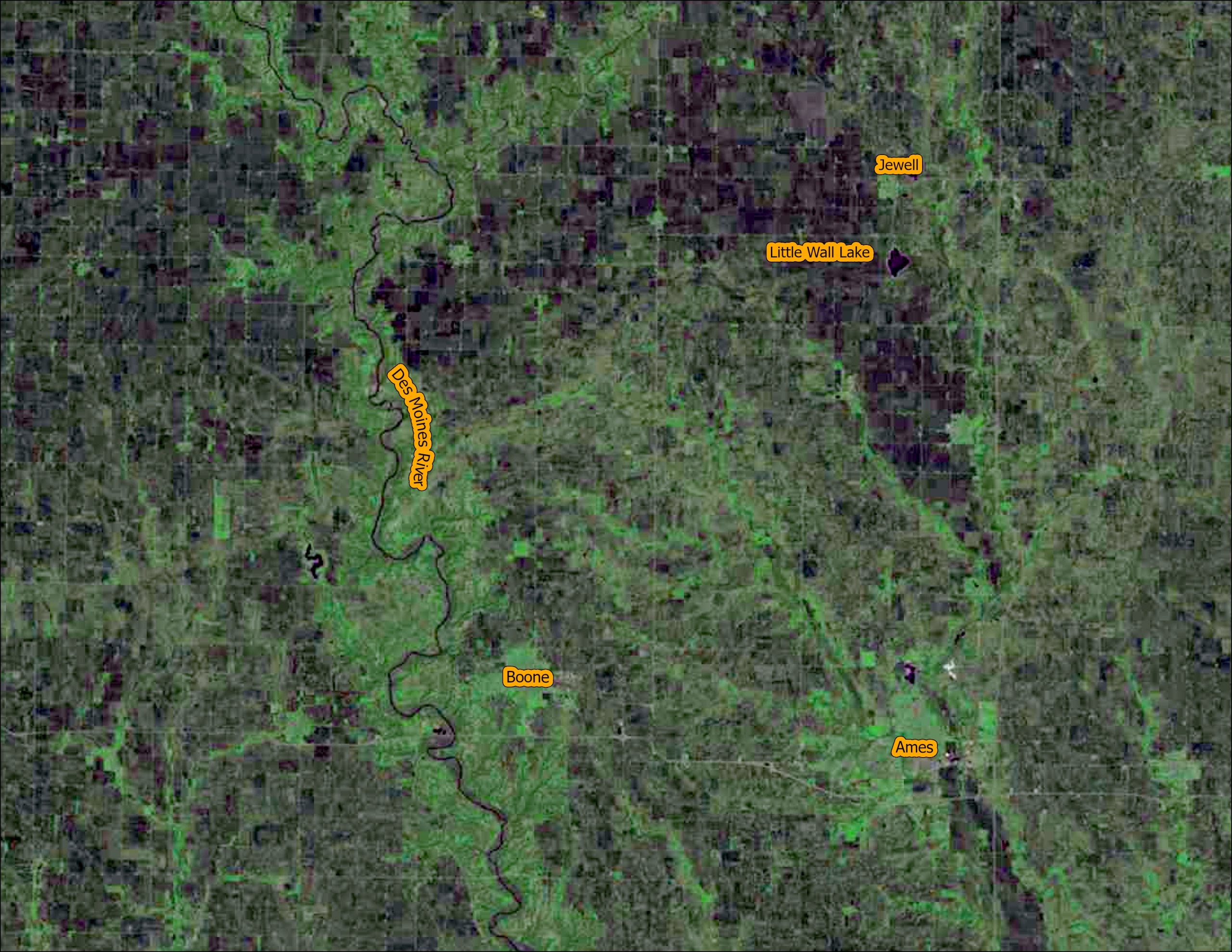
It’s another Throwback Thursday. Saylorville Lake and Dam are located in Central Iowa northwest of Des Moines, Iowa. The Saylorville complex was built to help with flood control and as a drinking water source for surrounding communities. At normal levels, the Saylorville reservoir stores 21.1 billion gallons of water with capacity at flood levels to hold 204.1 billion gallons of water.

Below are several resources if you are interested to learn more about this important structure north of Des Moines:


This year we are celebrating 50 years of the Landsat earth observing satellite mission. Landsat data helps us observe changes in our communities and environment over time.


Traveling Way Back – Landsat Images From Aprils Gone By

Welcome to another Throwback Thursday. Today we are going back into the archives to compare imagery from the first five Landsat satellites (all images are featured in natural color). Click on each image for a closer view.

  • Try to notice the differences in resolution and image quality between the different years.
  • Another thing to note is the wide seasonal variation between the images. All the images were from the same three week period in April. Some images are have snow while other years are very green.
  • Observe that the Des Moines River is swollen in the Landsat 4 -1983 image.
Landsat 1 – April 5, 1976
Landsat 2 – April 3, 1975

Landsat 3 – April 21, 1980
Landsat 4 – April 15, 1983
Landsat 5 – April 12, 1985

You can explore the raw images using this web app: https://arcg.is/0XrG4f. Happy exploring.


This year we are celebrating 50 years of the Landsat earth observing satellite mission. Landsat data helps us observe changes in our communities and environment over time.


Thanks for stopping by and keep observing the world around you!

Join in the Upcoming Summer GIS Workshop for Educators

Dear Teachers,

As the summer approaches, we wanted to encourage you to save the date for an upcoming GIS workshop for K-12 educators being held at William Penn University in Oskaloosa, Iowa on July 20-21, 2022.  See attached poster for more details.  Also please send us an email if you are interested but can’t make this event.  If there is enough interest, we may hold a second workshop, in August or the fall.

Please contact Amy Logan or Debbie Stevens with any questions.

Brushy Creek: The Birth Of A Reservoir – #Time Lapse Tuesday

Today’s time lapse video is highlighting the damming of Brushy Creek and the creation of 690-acre Brushy Creek Lake, Iowa’s deepest artificial lake.

Watch the dam development begin around 1994 and then the lake begin to fill around 1998. The Brushy Creek State Recreation Area is a 6500-acre park located in north central Iowa. To read more about the park at the Iowa Department of the Natural Resources Brushy Creek page: https://www.iowadnr.gov/portals/idnr/uploads/parks/parkmaps/brushycreekmap.pdf


This year we are celebrating 50 years of the Landsat earth observing satellite mission. Landsat data helps us observe changes in our communities and environment over time.


#TimeLapse Tuesday – Spot the Change – Urban Growth of Ankeny, Iowa

What changes do you notice in this Landsat time lapse video?

1) The areas of purple and white in the image are urban areas. Throughout the video they fill in the area from the bottom to the center. The pink areas are farm land.

2) Did you notice the increase in the number of retention ponds (dark blue specks in the urban areas) over time? Retention ponds are used to prevent flooding and provide for water storage in urban areas. As areas become urbanized there is often more surface covered in concrete, parking lots and buildings. There are fewer places for the water to flow directly into the ground.

3) Did you spot the golf course on the northern edge of the city?


This year we are celebrating 50 years of the Landsat earth observing satellite mission. Landsat data helps us observe changes in our communities and environment over time.


This video was created using Google Earth Engine. You can create your own time lapse videos by visiting: https://emaprlab.users.earthengine.app/view/lt-gee-time-series-animator.

#Landsat Throwback Thursday – 50 years of Growth in Dubai

Over the last 50 years, the city of Dubai, in the United Arab Emirates, has transformed from a small fishing and pearl diving village into a luxurious, modern metropolis. The population has grown from just over 100,000 residents in 1972 to an estimated 2.9 million residents in 2022. While the beauty and distinction of this city is undeniable, some question the sustainability of this fast-growing city located in a land of desert and salt water. The images are shown in false color infrared.  Areas appearing red show healthy vegetation. Notice the dramatic change from first image in 1973 (very little vegetation and urbanization) to 2022 with many areas of red far from the water. 

To create these images, individual bands were downloaded from the United States Geological Survey’s Earth Explorer Website (https://earthexplorer.usgs.gov/) in April 2022. The composite false color infrared images were created in ArcGIS Pro using the composite imagery processing tool.


This year we are celebrating 50 years of the Landsat earth observing satellite mission. Landsat data helps us observe changes in our communities and environment over time.


Happy Earth Day 2022: Enjoy NASA’s Pathways to New Discoveries

This year NASA’s Earth Day poster is features a series of QR codes which provide an array of information on a number of their missions, programs, and activities. We have provided a key below explaining each of the numbered QR codes along with the link to each code (click on the name to follow the link.)

  1. Artemis
  2. Landsat 9
  3. Climate Time Machine
  4. Climate Quizzes
  5. Images of Change
  6. Eyes on Earth
  7. Benefits from Space
  8. Rising Tides
  9. Snack Time with NASA
  10. Benefits on Earth
  11. GLOBE Observer
  12. NASA Earth Day
  13. Earth from Afar
  14. Earth Science
  15. Live views from Space
  16. NASA Aeronautics
  17. 2022 Earth Day Poster

Announcing the Golden Jubilee of the Landsat Mission

This year marks the 50th anniversary of the launch of the first Landsat satellite (July 23, 1972). To celebrate fifty years of earth observation, IowaView will be posting various images and gif documenting Landsat in Iowa and around the world. Check back regularly for new images and articles. #TimeLapseTuesday #ThrowbackThursday