The geospatial community has been doing a good job of mapping known COVID-19 cases. Having data in a map can often help us with decision making and help keep things in perspective.
ESRI has a COVID-19 GIS Hub which has a lot of great maps (estimated peak maps and unemployment maps), data and applications.
Below are links to other useful websites:
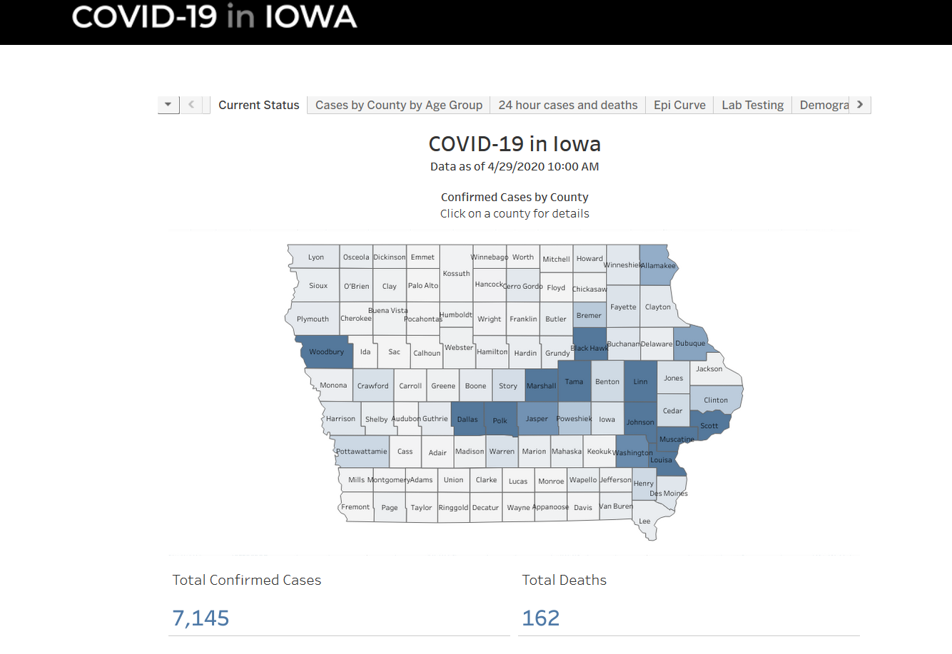
– The State of Iowa has a COVID-19 page: https://coronavirus.iowa.gov/. This has a dashboard with several maps displaying the current status of COVID-19 in Iowa.
– John Hopkins University has a map of global cases of the Coronavirus COVID-19 including data about confirmed cases, deaths, recovered, and active cases: https://www.arcgis.com/apps/opsdashboard/index.html#/bda7594740fd40299423467b48e9ecf6

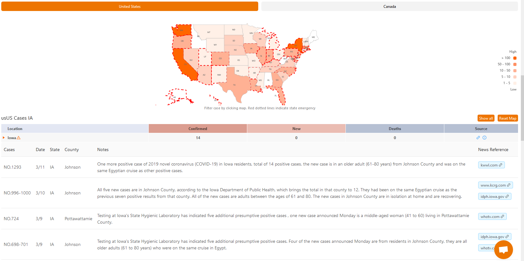
– Another helpful map is produced by 1point3acres, it provides details about each individual case and includes case number, date confirmed, county, and other case notes. https://coronavirus.1point3acres.com/en