Riparian buffers are areas of permanent vegetation (grass or trees) next to water resources which provide a number of ecosystem services including: erosion control, habitat, and nutrient and contaminant removal from surface runoff. For this project we were interested in creating a baseline data set of riparian areas along stream corridors.
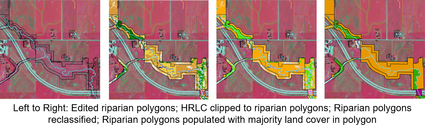
A semi-automated method was developed to identify and classify the non-crop riparian land bordering main stream channels. This technique used stream centerlines to locate common land unit polygons within a 2 meter distance of the stream centerline. Technicians then reviewed and modified the polygons based on aerial photography and LiDAR elevation data. The resulting polygons were then given land cover values based on high resolution land cover data.