Tag Archives: Iowa Geographic Information Council

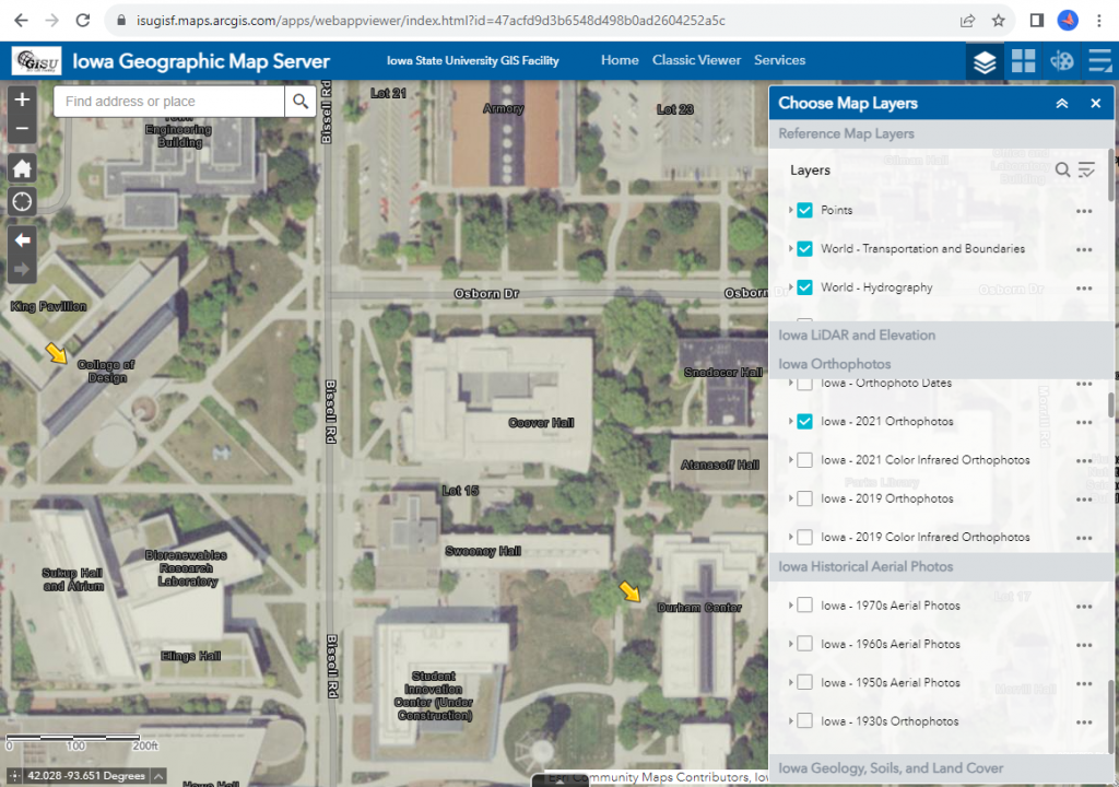
Day 5 GAW: Have you discovered the Iowa Geographic Map Server?

  • elevation maps (LiDAR and USGS topographic maps),
  • historical maps (General Land Office survey maps from 1800s, Andreas Atlas, historic topography),
  • land cover maps (historical and contemporary)
  • geology (landforms and bedrock)

It’s time to Spread the word about the Iowa Map Contest!

The Iowa Map Contest is open. This year we would like to give out all our prize money. If you know students in grade 4-12 or teachers encourage them to participate. For contest details, visit: https://sites.google.com/site/iowamapcontest/.

Here’s a link to the poster pdf: https://www.iowaView.org/wp-content/uploads/2022/03/Iowa_map-contest-poster_smaller-compressed-1.pdf.

Iowa/Utah Geospatial Exchange: IGIC Lunch and Learn

December 2021 IGIC Lunch & Learn: Iowa/Utah Geospatial Exchange

This presentation will provide an introduction to the Iowa Geospatial Conference Exchange, a program to encourage sharing of GIS programs, data, and knowledge between state organizations. Amy Logan and Penny Vossler have returned from geospatial exchange in Utah with examples of Utah’s geographic resources and strengths, some great ideas from their conference, new friends, and great photos to share.

For more information: https://www.iowagic.org/event/december-2021-igic-lunch-learn-iowa-utah-geospatial-exchange/

Here is a link to the recording (12/15/2021): https://iastate.webex.com/iastate/ldr.php?RCID=3c87c93211016276d525d62cadc6e4dd

Discover your local geographic Information Council and other groups

The Iowa Geographic Information Council (IGIC) is an organization of geospatial professional across the of Iowa. It provides geospatial support allowing individuals to ask questions and provides opportunities to collaborate as well as network. IGIC is governed by a 25 member board which represent 9 different sectors. There are quarterly meetings as well as a yearly conference (Iowa Technology and Geospatial Conference) and other opportunities to connect with geospatially minded people.

IGIC hosts monthly virtual Lunch and Learn events. These have been very successful for IGIC especially as members are widely distributed across the state.  Each session is recorded and available on the IGIC website.

You are invited to join this month’s “GIS Day” Lunch and Learn: Mulitpurpose Use of Street Level Imagery with Bill Wetzel, Cyclomedia Technology @ 12pm – Wednesday November 17, 2021. He will discuss how local governments and utilities rely on technology initiatives that optimize management of properties, assets, and infrastructure. For more information: https://www.iowagic.org/igic-lunch-learn-street-level-imagery/ .

Iowa Student Map Contest 2021: Mapping Unique Iowa Features

The 2021 Map Competition for Iowa students is now underway.

Students in grades 4-12 are invited, with their teachers, to participate in this year’s mapping contest sponsored by Esri, the Iowa Geographic Information Council (IGIC), and William Penn University. This year’s theme is Mapping Unique Iowa Features.

Contest Website: https://sites.google.com/site/iowamapcontest/home

Story Maps Website: https://www.esri.com/en-us/arcgis/products/arcgis-storymaps/overview

How to participate: Use the Story Map application to tell a story about a unique feature site using a map and pictures.

There will be $100 cash prize and a certificate for the top five middle school (grades 4-8) and top high school (grades 9-12) map entries. The top entry from each state will be submitted to the national competition hosted by Esri.

Schools must submit their winners to the state for judging by 5 p.m. on Wednesday, May 12, 2021. Iowa GIS professionals will judge the entries so Iowa awards may be announced, and send winning entries on to Esri for the national competition.