Tag Archives: #IowaView

Timelapse Tuesday – 37 years of Urban Growth in Ames, Iowa

This week we are exploring urban growth in Ames, Iowa. The red areas are showing areas of vegetation that are primarily agricultural in the larger areas, the neon green areas are short grass and trees, the gray color is urban areas, and blue areas are water.

Timelaspse Video of Ames, Iowa 1984 to 2021 – Summer Landsat Images

As you watch the time lapse video notice several things:

  1. The expansion of Ada Hayden (the large lake in the center right of the image.)
  2. How the agricultural land in the center of the images fills in rapidly with development between 2008 to 2021
  3. The increase in permanent water retention ponds in as the city develops.
  4. Many of the red agricultural parcels along Ioway Creek (the left river) become smaller and more developed through the time series.

Compare an image of north Ames, Iowa from 1987 to 2021 – what other urban growth changes can you spot?

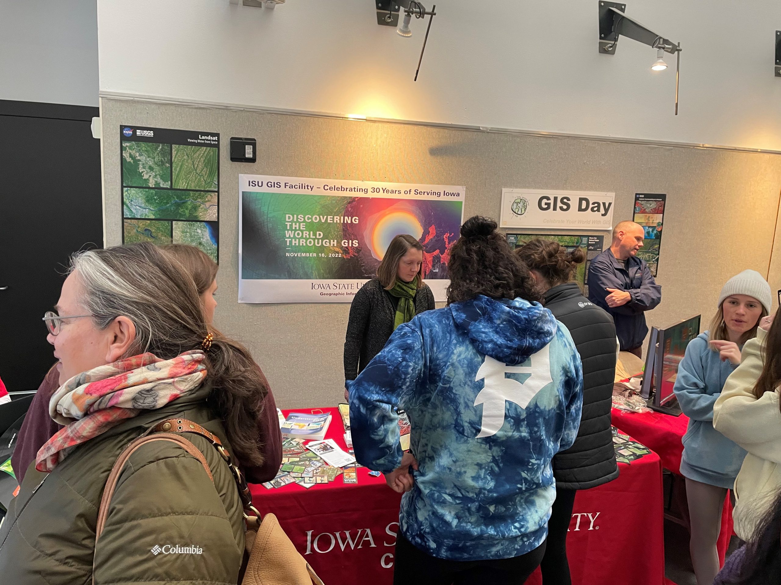
Photos from ISU GIS Day 2022

Celebrating 30 years of GIS at ISU today on GIS Day! We also celebrated the 50th anniversary of Landsat and were able to hand out playing cards, refreshments, posters, and other educational materials. This was a great opportunity for our staff in the GIS facility to share the work that they are doing, and teach others about GIS.

Celebrate with us today! 30 years of GIS at ISU!!!

Today is GIS Day! We are celebrating in the North atrium of the College of Design. Today is an especially exciting celebration as we are also celebrating the 30th anniversary of the ISU GIS Facility on campus and 50 years of the US Landsat, earth observing satellite mission. Please join us in the College of Design from 11:30am to 2:00 pm. We will have several activities, puzzles, refreshments, educational giveaways, and door prizes.

For additional information and directions, visit: https://www.design.iastate.edu/event-listings/2022/11/gis-day-open-house-event/.

Are you Counting Down to GIS Day 2022?

Wednesday, November 16, 2022, the Iowa State University GIS Facility will be hosting an open house event for GIS Day from 11:30 to 2:00 in the North atrium of the College of Design.

This year we will also be celebrating the 30th anniversary of the ISU GIS Facility and 50 years of Landsat, the US Land Satellite mission. We will have refreshments and giveaways. It will be a chance for students interested in the GIS minor and GIS certificate programs to ask questions and to meet with GIS professionals. We have confirmed professionals from the Iowa Department of Transportation coming to showcase some of their work. If other GIS professionals are interested in reserving time to meet with students, please contact Amy Logan.

Disaster at Lake Delhi – #Landsat50

Well, it’s Water Wednesday. Today’s Landsat highlight is a time lapse video (2007-2017) showing the effect of a 2010 dam breach on the water level of Lake Delhi located in Delaware County in eastern Iowa. Notice the dramatic decrease in water and the exposure of large sandbars and the refilling of the lake as the dam is restored.


This year we are celebrating 50 years of the Landsat earth observing satellite mission. Landsat data helps us observe changes in our communities and environment over time.


How are you celebrating the Landsat’s Golden Jubilee?

This image is from the Camp Landsat website: https://landsat.gsfc.nasa.gov/outreach/camp-landsat/

To celebrate the Landsat Golden Jubilee, consider taking a virtual visit to Camp Landsat! This summer Camp Landsat is celebrating this exciting anniversary with 5 weeks of programming, celebrating the 5 decades of Landsat’s continuous mission. This week the theme is People and Places.

Enjoy and explore many activities from Camp Landsat including:

Graphic from GLOBE Program Website: https://observer.globe.gov/do-globe-observer/challenges/land-cover-challenge-2022

Stay Cool and Keep Observing!


Celebrating 50 years of Landsat Earth Observation!

Saturday, July 23, 2022 marked the 50th anniversary of the launch of the USGS/NASA Landsat earth observing satellite mission. With the launch in 1972, Landsat has continued its earth observation mission and become the longest continuous earth observing satellite.

July 1972 – Landsat 1 Launch: This image is from the NASA website: https://www.nasa.gov/directorates/heo/scan/images/history/July1972.html

Enjoy this video recalling the launch and explaining the beginning of the earth observing satellite mission, Landsat 9 – Part 1: Getting off The Ground: https://www.youtube.com/watch?v=FlRf17Egexo.


Keep Observing!


Geography Awareness Week: Review and Contribute to OpenStreetMap

OpenStreetMap (OSM) is a publicly created and maintained world map – the Wikipedia for maps. Anyone with access to an internet browser can view the map and anyone with a free OpenStreetMap account can update the map. If you are new to OpenStreetMap visit their welcome page to a short introduction: https://osmgeoweek.org/guides/intro .

Here are several ways to get engaged with OpenStreetMap:

~ Review your local OSM basemap for accuracy and consider adding community features that are missing or need updating.

~ Spend time working on a Humanitarian OpenStreetMap project. For a current list of priority project visit: https://tasks.hotosm.org/explore

~ Consider joining mappers around the globe in the November OSM US 30 Days of Mapping Challenge (each day has themed asset to map): https://wiki.openstreetmap.org/wiki/United_States/Projects#30_Days_of_Mapping_-_November_annually

GIS Day 2021 – Success!

Here are photos from yesterday’s GIS Day event. We had over 50 visitors stop by our table in the ISU College of Design lobby for information about undergraduate minor in GIS and graduate GIS certificate, cupcakes, posters, trading cards and to help put our map puzzles together.